
Features ЕКС ЯНАО
The application is designed to work with electronic maps published in the Unified Cartographic System of the Yamal-Nenets Autonomous Okrug (EKS).
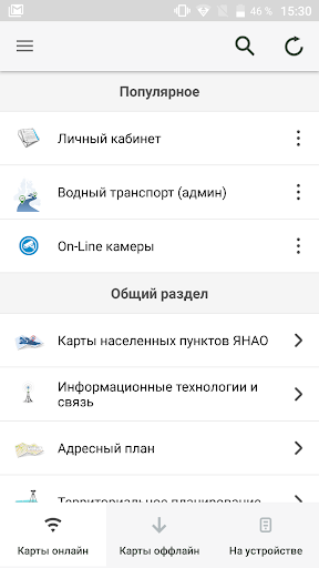
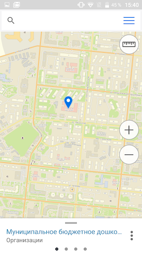
EKS is a system of centralized accumulation, updating, storage of large volumes of digital cartographic and thematic information (electronic maps, aerospace photographs, agreed on territorial coverage, content, format, scale, systems of conventional signs and classifiers, etc.), its processing and provision of regulated access to published data to users.Key features:• Map catalogUse all the variety of thematic electronic maps published in the EKC catalog on your mobile device.• Working with the mapUse convenient tools for working with the map - viewing information about objects on the map, adjusting the visibility of layers.• Photos and routesAdd photos and descriptions of interesting objects to the map.
The photos will be saved on the EKS server, which will allow you to view this data through your personal account.• Autonomous workWork with the map in the most inaccessible places, regardless of the availability of the Internet.
For offline work, you must first download the desired map from the offline maps catalog.
You can also collect data (photos and routes) offline.
The collected data will be uploaded to the server when Internet access appears.Any questions or comments regarding the use of the application can be asked at [email protected]
Camera Features
Advanced camera features with editing capabilities.
Food & Dining
Discover recipes and order food from your favorite restaurants.
Smart Home
Control and monitor your home with smart features.
See the ЕКС ЯНАО in Action
Get the App Today
Available for Android 8.0 and above